Exploring the Depths: Capricorn Caves’ 3D Mapping Odyssey using LiDAR Technology
Innovations Natural Resource Management
By Jillian Neyland, Education Officer, Capricorn Caves
Until only recently, the only map we had of the Capricorn Caves was a hand drawn one. This beautiful map helped countless staff and visitors explore and learn about the cave system. But as technology has improved over the decades, so too has our ability to map this amazing natural resource in finer detail.
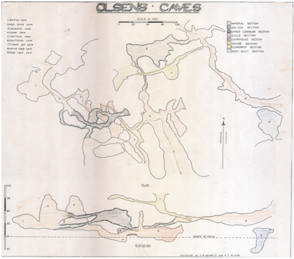
In 1968, the previous land owner Mr Olsen and his friend, cave enthusiast Mr Semple, surveyed and mapped the cave with basic equipment such as a compass, and a homemade theodolite constructed from a spirit level and a school protractor.
Over 50 years later, Capricorn Caves Natural Resource Manager, Lydia, is completing Phase 2 of our new mapping project. Her aim is to use LiDAR technology to map all the major caverns and trails in the Capricorn Caves.
The high resolution data collected will allow our engineers and builders to plan and construct replacement infrastructure like bridges and boardwalks. It will also be used to improve tourism experiences and to assist with any scientific research undertaken in the cave habitat.
What is LiDAR?
Our Education Officer, Jillian, accompanied Lydia into the cave to learn more about this cool science technology. LiDAR stands for Light Detection and Ranging. It is a remote sensing method that uses a pulsed laser to determine and record the distances between thousands of points in a space. It also records photographic images which are linked to these points.
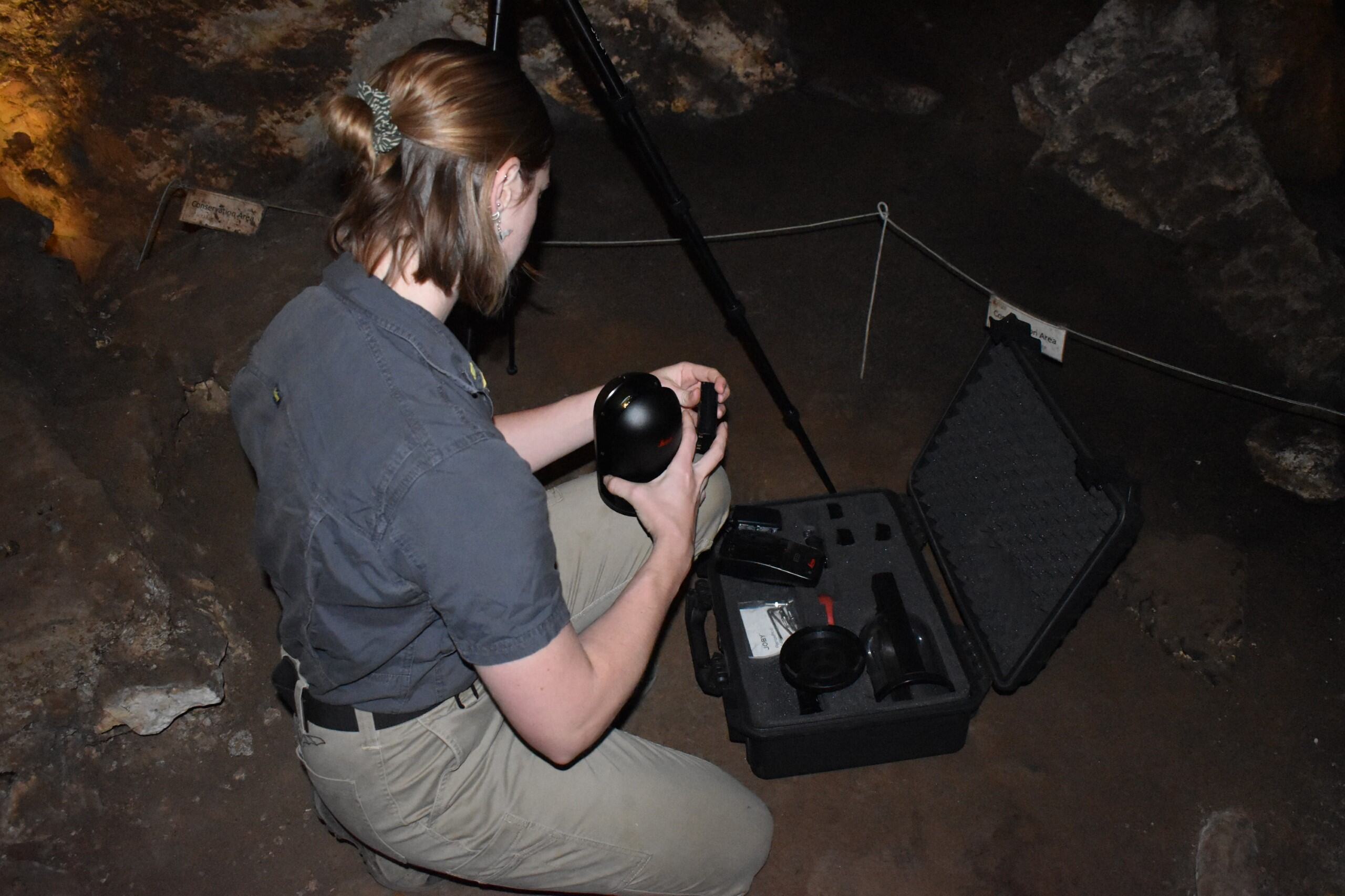
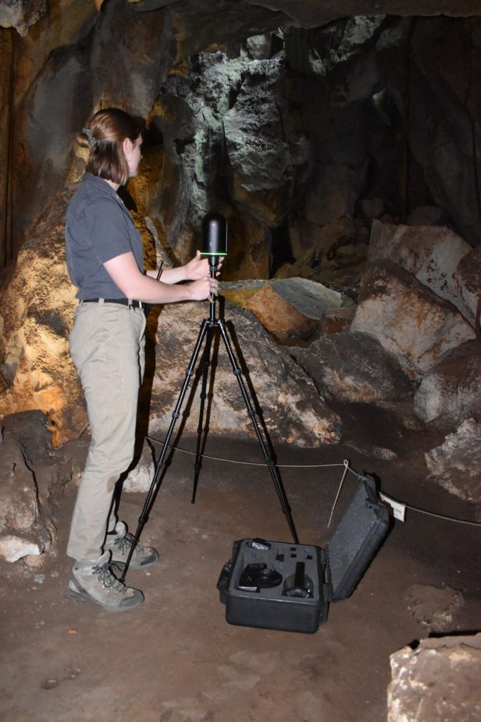
The Leica LiDAR unit and computer accessories Lydia is using for this mapping project are on loan from the nearby Central Queensland University. Luckily, the equipment is relatively easy to move around using a protective hard case. It is also quick to set up. The sensing unit is fixed to a tripod.
Once in position and activated, it takes approximately six minutes for the LiDAR unit to complete a scan of the surrounding space, in this case, a section of cave. Lydia does multiple scans in a cavern from different points to capture all the nooks and crannies, and build a layered, more accurate map.
What do we do with LiDAR data?
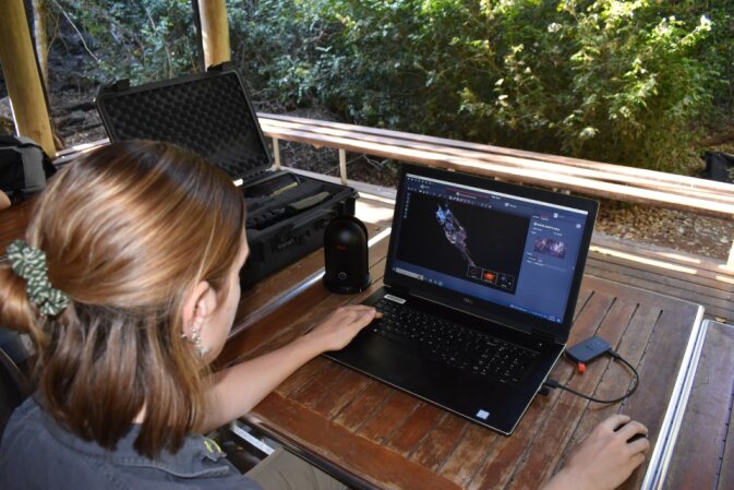
The data collected is downloaded using Leica Cyclone Register 360 software onto a hi-spec Dell Laptop. This software translates the point cloud into a 3D image which you can navigate through using a mouse, just like a computer game.
Many people have seen similar imagery on websites advertising Real Estate or Prize Homes. Using the mouse, you can jump from circle to circle. These circles are where the LiDAR unit was positioned when completing a 360 degree scan.
One useful application of the LiDAR data being collected at Capricorn Caves is for improving the infrastructure. Engineers working remotely can choose two points in the virtual 3D cave image to determine the distance between them. Angles can also be measured.
Our recently installed new Swinging Bridge, a tourist favourite, was designed with the help of data collected in the first phase of the Cave Mapping Project completed in 2021.

A 3D mesh model of the cave was created using Leica Cyclone 3DR software. Currently, the point cloud consists of 18 billion individual captured points (a lot of data!). To create the meshed model Lydia significantly reduced the number of points and created a low-resolution model to derive surface area and volume of the cave.
There are countless applications for the data being collected, much of which can benefit ecology researchers. Here are just some of the interesting research questions that could be explored using the LiDAR data being collected at Capricorn Caves.
- Determine how the volume or surface area of caves influences bat colony populations.
- Map the potential flight paths for cave dwelling bats.
- Predict water flow during past or future flood events.
- Measure the erosion of cave surfaces over time.
- Monitor the spread or growth of rock loving organisms such as algae, moss, fungi, cyanobacteria, cave ferns and even measure the length of fig tree roots.
- Gain a better understanding of the turnover and flow of gases such as CO2 & O2 within the caves.
- Correlate data on humidity and temperature and understand how cave volume or surface area impacts these variable factors.
- Produce 3D models of the cave for educational purposes.
- Create virtual cave tours for people who have limited mobility.
- Find lost tourists (just kidding!)
For students who are interested in this type of work, you could investigate doing tertiary studies in ecology, geology, surveying or civil engineering. Many industries such as construction, mining, robotics and defense have adopted LiDAR technology to improve their operations, services, research or products.
LiDAR technology can also be fitted to drones and used in industries such as agriculture, forestry and even archeology. You may even have a robotic vacuum in your house that uses LiDAR technology to make sure it doesn’t fall down the stairs!
We hope to share with you in the future some of the results of this mapping project.
Recent Posts